Every day around 8 million pieces of plastic makes their way into our oceans. While preventing this from happening is crucial, tracking what’s already there, so they can be cleaned up is just as important.
Researchers from RMIT University, Australia, have discovered a way to use satellites to help locate plastic waste on remote beaches not visible in conventional images.
“Stopping plastic from entering the ocean is a global challenge,” said Jenna Guffog, RMIT University PhD candidate and lead author of the study. “But if we can find and remove them quickly, it’s the next best thing.”
The study, now published in Remote Sensing, use the unique infrared signals reflected by plastics to identify even the tiniest particles among the vast stretches of the coastline.
According to the researchers, this helped set the foundation for allowing plastics, even those smaller than a pixel, to be detected within satellite images.
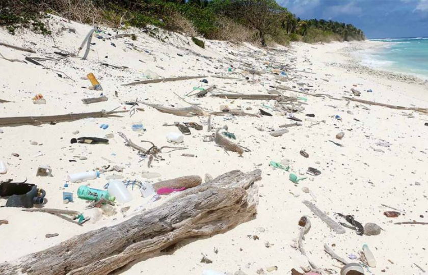
The fieldwork was trialled by Guffog and her team on the remote beaches of Cocos (Keeling) Islands, using sensing equipment to capture how infra-red light was reflected by various types of plastic found in the area.
Researchers used spectral library plots to compare plastics’ reflectance with their cover to calculate how much plastic washed up on the shore.
Afterwards, they compared spectral readings from the weathered plastics with virgin plastics that hadn’t been exposed to environmental degradation and found little difference between results.
Meaning that it doesn’t matter what shape, colour, or condition of the plastic; they can be detected remotely using satellites and their location can be shared.
“At the moment, plastic debris is tracked by passing vessels notifying authorities. Using satellites will allow more frequent and reliable observations,” Guffog added.
According to the scientists, their research can help organisations with remote coastal and marine waste clean-up management knows where to focus their efforts. In addition, the technology can also track an area’s health by the amount of plastic it detects.
Simon Jones, RMIT professor, remote sensing, said that the study was about looking for ways satellites can be used to see things that the human eye can’t.
“In the next few years, we’re going to launch satellites with even better remote sensing capabilities,” he said. “We’re developing ways to use these new satellites in the fight against marine waste.”
‘Quantifying marine plastic debris in a beach environment using spectral analysis’ with co-authors Jenna Guffogg, Samantha Blades, Mariela Soto-Berelov, Chris Bellman, Andrew Skidmore and Simon Jones is published in Remote Sensing (DOI: 10.3390/rs13224548).